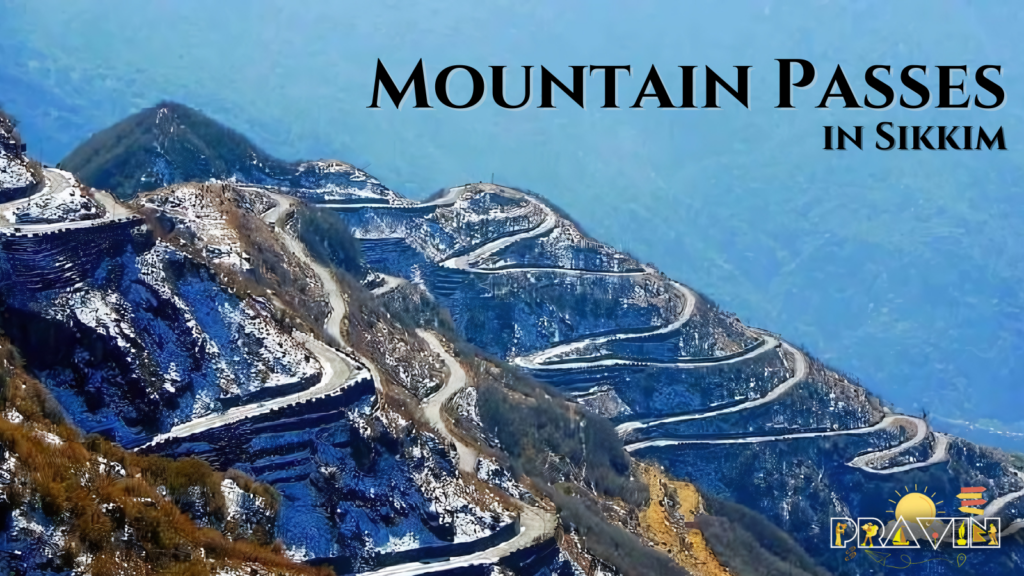
Sikkim, a small state in northeast India, is known for its stunning natural beauty and adventurous mountain passes. These passes connect different parts of the state through the Himalayan mountains, offering travelers amazing views and unforgettable experiences. Let’s take a closer look at the 7 best mountain passes in Sikkim.
1. Nathu La Pass
Location and Elevation
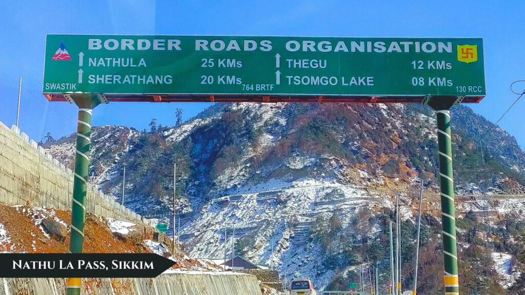
Nathu La Pass is located on the border between India and China, connecting the Indian state of Sikkim with China’s Tibet Autonomous Region. It sits at an elevation of 4,310 meters (14,140 feet) above sea level.
Historical Significance
Nathu La Pass has been an important trade route between India and China for centuries. It was part of the ancient Silk Road, facilitating the exchange of goods and culture between the two regions. The pass was closed after the 1962 Sino-Indian War and reopened in 2006 following trade agreements between the two countries.
Visiting Nathu La Pass
To visit NathuLa Pass in Sikkim, Indian citizens need to obtain a permit in Gangtok, the capital of Sikkim. The pass is open from Wednesday to Sunday. Visitors can enjoy beautiful views of the surrounding mountains and learn about the history and cultural significance of the pass.
Nathu La Pass is one of the highest motorable mountain passes in the world, located at an elevation of 14,140 feet (4,310 meters). It connects the Indian state of Sikkim with China’s Tibet Autonomous Region.
Highlights of Nathu La Pass
- Location: East Sikkim, around 55 km from the state capital Gangtok
- Elevation: 14,140 feet (4,310 meters)
- Connects: Sikkim, India with Tibet Autonomous Region, China
- Historical significance: Part of an ancient trade route (the Silk Road) between India and Tibet/China
- Current status: Open border trading post between India and China, only open to Indian citizens with permits
- Best time to visit: May to October, as it experiences heavy snowfall and sub-zero temperatures in winter
- Nearby attractions: Tsomgo Lake, Baba Mandir, scenic viewpoints of the Himalayas
2. Jelep La Pass
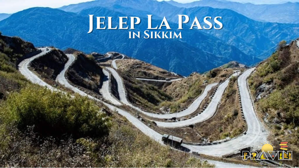
Location and Routes
Jelep La Pass is situated between Sikkim, India and Tibet, China at an elevation of 4,267 meters (13,999 feet). There are two routes to access the pass on the Indian side – one through Gangtok and the other through Kalimpong.
Scenic Beauty
The route to Jelep La Pass in Sikkim is very scenic, with forests of rhododendrons that bloom beautifully in the spring. Numerous small villages and hamlets dot the surrounding landscape. The pass also offers views of the Menmecho Lake which flows below it.
Jelep La Pass is another high mountain pass in Sikkim, located slightly south of Nathu La at an elevation of 14,390 feet (4,386 meters). It connects Sikkim with the Chumbi Valley in Tibet.
Highlights of Jelep La Pass
- Location: East Sikkim, around 4 km south of Nathu La Pass
- Elevation: 14,390 feet (4,386 meters)
- Connects: Sikkim, India with Chumbi Valley, Tibet Autonomous Region, China
- Name meaning: The meaning of the name of Goecha La is “The lovely level pass” in Tibetan, as it is the most gradual of the passes between Sikkim and Tibet
- Historical significance: Important trade route, used frequently during British rule of India
- Current status: Closed since the 1962 Sino-Indian War, but talks of reopening
- Routes: Two routes from the Indian side – one from Gangtok and the other from Kalimpong
- Nearby attractions: Menmecho Lake, small military settlements, rhododendron forests in spring
3. Dongkha La Pass
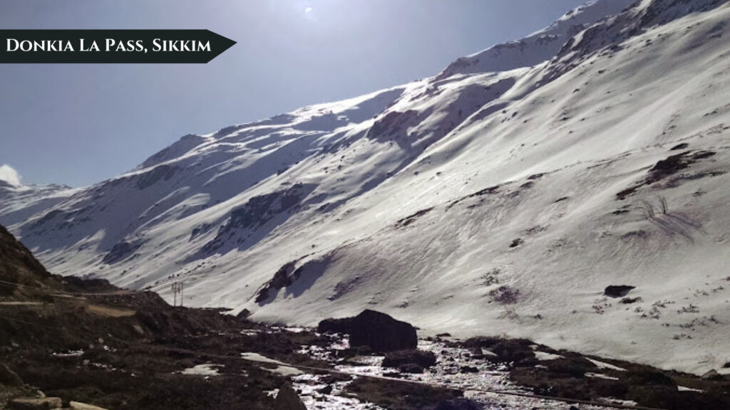
Location and Elevation
Dongkha La Pass, also known as Donkia Pass, is one of the highest passes in Sikkim at an elevation of 5,534 meters (18,156 feet). It connects the Indian state of Sikkim with the Tibetan Plateau.
Nearby Lakes and Rivers
The pass offers views of the nearby Tso Lhamo Lake which is 6.5 km long and 2.5 km wide. This lake is the source of the Teesta River. Another lake called Gurudongmar Lake, located about 5 km northwest, also feeds into the Teesta River.
Dongkha La, also known as Donkia Pass in Sikkim, is a high altitude pass on the border between North Sikkim and Tibet. At 18,156 feet (5,534 meters), it is one of the highest motorable passes in the world.
Highlights of Dongkha La Pass
- Location: North Sikkim, near the Chinese border
- Elevation: 18,156 feet (5,534 meters)
- Alternate name: Donkia Pass
- Connects: North Sikkim, India with Tibet Autonomous Region, China
- Nearby attractions: Tso Lhamo Lake (source of Teesta River), Gurudongmar Lake, views of Tibetan Plateau
- First surveyed by: Joseph Dalton Hooker in 1849, who described it as the most treacherous pass he had encountered
- Current status: Controlled by Indian Army due to proximity to Tibet border, special permits required to visit
- Best time to visit: March to May and October, closed in winter and monsoon months
- Tips: Wear warm clothes, ensure physical fitness, carry water/snacks/medicine as there are no settlements along the way
4. Chiwabhanjang Pass
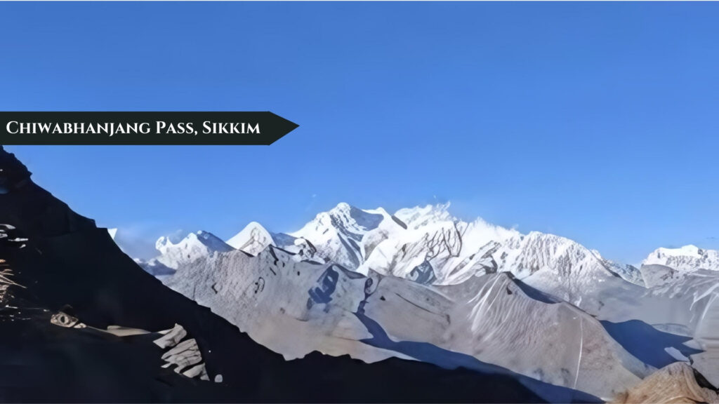
Location and Elevation
Chiwabhanjang Pass, also known as Chiyo Bhanjyang or Chiya Bhanjyang, is an international mountain pass located on the border between Nepal and Sikkim, India. It sits at an elevation of 3,139 meters (10,299 feet).
Connecting Highways
The pass is the starting point of Nepal’s Mid-Hills Highway (Pushpalal Highway) which runs across the middle hills of the country. On the Indian side in Sikkim, the Uttarey-Chiwa Bhanjyang road starts from the pass and connects to the state capital Gangtok, 170 km away.
Chiwabhanjang Pass in Sikkim is located in West Sikkim at an altitude of 10,299 feet (3,139 meters), connects Sikkim with Nepal. It is the starting point of Nepal’s Pushpalal Mid-Hill Highway.
Highlights of Chiwabhanjang Pass
- Location: West Sikkim
- Elevation: 10,299 feet (3,139 meters)
- Alternate names: Chiwa Bhanjyang Pass, Chio Bhanjyang Pass
- Connects: West Sikkim, India with Nepal
- Significance: Starting point of Nepal’s Pushpalal Mid-Hill Highway
- Nearby attractions: Two scenic high altitude lakes called Bhut-Pokaris
- Route from Sikkim: 3 hour steep hike from Uttarey
5. Goecha La Pass
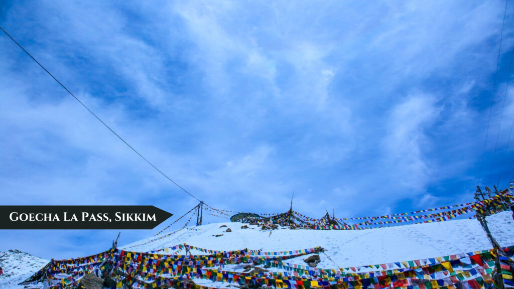
Popular Trekking Destination
Goecha La Pass is a very popular trekking destination in Sikkim known for its amazing natural beauty. The pass is located at an elevation of approximately 4,940 meters (16,200 feet).
Views of Kanchenjunga
One of the main highlights of trekking to Goecha La Pass in Sikkim is the stunning view of Mount Kanchenjunga, the third highest mountain in the world. On a clear day, trekkers can see the entire Kanchenjunga range from the pass.
Goecha La is a high mountain pass in West Sikkim famous as a trekking destination. At approximately 16,200 feet (4,940 meters), it offers spectacular views of the Kanchenjunga range.
Highlights of Goecha La Pass
- Location: West Sikkim, on the trekking route from Yuksom to Dzongri and Goechala
- Elevation: Approximately 16,200 feet (4,940 meters)
- Significance: Stunning viewpoint for the Kanchenjunga massif and surrounding peaks
- Trek duration: Usually 10-11 days round trip from Yuksom
- Best time to trek: Mid-March to May and October to mid-December
- Highlights: Rhododendron forests, high altitude lakes, diverse landscapes, magnificent Kanchenjunga views
6. Naku La Pass
Location and Elevation
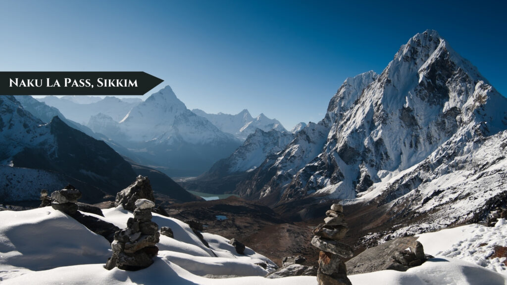
Naku La Pass is situated along the border between Sikkim, India and Tibet, China. It has an elevation of around 5,000 meters (16,400 feet) above sea level.
Strategic Importance
The pass holds strategic importance due to its location on the India-China border. It is one of the frontier passes that is patrolled and monitored by the Indian army.
Naku La Pass in Sikkim is a high mountain pass located in East Sikkim that connects India and China. At 16,400 feet (5,000 meters), it is an important strategic point along the Sino-Indian border.
Highlights of Naku La Pass
- Location: East Sikkim, near the Tibetan border
- Elevation: Approximately 16,400 feet (5,000 meters)
- Significance: Strategic military pass along the India-China border
- Current status: Controlled and patrolled by the Indian Army
7. Cho La Pass
Challenging Trek
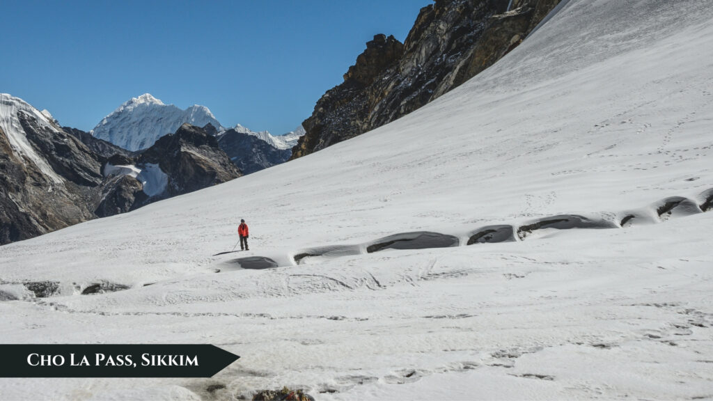
Cho La Pass is known as a challenging trekking pass in Sikkim. It connects the Dzongri and Thanggu areas in West Sikkim. The pass sits at an elevation of approximately 5,330 meters (17,490 feet).
Remote Wilderness
Trekking over Cho La Pass takes you through very remote and wild areas of Sikkim. The surrounding landscape is rugged and beautiful, with very few signs of human habitation. Trekkers can experience a true sense of adventure and solitude here.
Cho La Pass in Sikkim is a high altitude pass in North Sikkim that connects the Muguthang and Lachen valleys. Height of Cho La Pass is 17,490 feet (5,330 meters), it is a challenging trek for experienced hikers and adventurers.
Highlights of Cho La Pass
- Location: North Sikkim, on the trekking route between Muguthang and Lachen valleys
- Elevation: Approximately 17,490 feet (5,330 meters)
- Significance: Challenging high-altitude trek with stunning mountain views
- Trek duration: Usually 6-7 days including acclimatization
- Best time to trek: Mid-April to June and Mid-September to October
- Highlights: Rugged mountain terrain, alpine lakes, remote valleys, views of Kanchenjunga and other peaks
Conclusion
The mountain passes of Sikkim offer a perfect blend of natural beauty, adventure, and cultural experiences. From the historically significant Nathu La Pass to the trekkers’ paradise of Goecha La, there is something for everyone. While some passes like Nathu La and Jelep La are accessible by road, others like Cho La are only reachable by trekking.
Regardless of how you get there, these passes provide an opportunity to witness the raw beauty of the Himalayas and create unforgettable memories. So pack your bags and get ready to explore the stunning mountain passes of Sikkim!
Frequently Asked Questions
1. What is the best time to visit the mountain passes in Sikkim?
The best time to visit most passes is from April to June and September to November. Some passes may be closed in winter due to heavy snowfall.
2. Do I need any permits to visit the passes?
Yes, permits are required to visit many of the passes, especially those located near the international borders like Nathu La and Jelep La. Permits can be obtained through registered tour operators in Gangtok.
3. What should I pack for a trip to the mountain passes?
Pack warm clothes, sturdy shoes, sunscreen, sunglasses, and a hat. Carry enough water and snacks. Don’t forget your camera to capture the stunning views!
4. Are the passes safe to visit?
Yes, the passes are generally safe to visit. However, always check the current conditions and follow the instructions of your guide or tour operator. Some passes may be off-limits due to weather or security reasons.
5. Can I trek to the passes independently?
While some passes can be trekked independently, it is recommended to go with a guide or join a trekking group, especially if you are inexperienced or unfamiliar with the area.
6. Are there any accommodation options near the passes?
Accommodation options vary depending on the pass. Some passes like Nathu La have tourist facilities nearby, while others may require camping or staying in basic lodges.
7. How physically fit do I need to be to visit the passes?
The fitness level required depends on the pass and the mode of transportation. Passes accessible by road can be visited by most people, while trekking passes require a good level of fitness and endurance.
8. What is the altitude sickness risk at the passes?
The risk of altitude sickness increases at high elevations. It is important to acclimatize properly and descend immediately if symptoms occur. Consult with your doctor before visiting high-altitude passes.
9. Are there any cultural sites to visit near the passes?
Yes, many passes have cultural and historical sites nearby, such as monasteries, temples, and war memorials. Your guide or tour operator can provide more information.
10. Can I visit all the passes in one trip?
Visiting all the passes in one trip may not be possible due to time constraints and logistics. It is best to prioritize the passes you want to see and plan accordingly.
11. Are the passes open year-round?
No, most passes are closed during the winter months due to heavy snowfall and harsh weather conditions. Check the specific opening dates for each pass.
12. Can I drive my own vehicle to the passes?
Driving personal vehicles may not be allowed for some passes due to permit restrictions or road conditions. It is best to check with the local authorities or your tour operator.
13. Are there any food options available at the passes?
Food options may be limited at the passes themselves, but there are usually local eateries or packed food available in nearby towns or villages.
14. What kind of wildlife can I expect to see at the passes?
The passes are home to a variety of wildlife, including musk deer, blue sheep, and Himalayan birds. Keep an eye out for these creatures, but remember not to disturb them.
15. Can I camp at the passes?
Camping may be allowed at some passes, but it is important to check with the local authorities and obtain necessary permits. Follow Leave No Trace principles and camp only in designated areas.

